Mehar is a small town located in Sindh, Pakistan. It is positioned at coordinates 27.1795221, 67.8210557, and is home to about 460,000 people as of the 2017 census. The city is livelier because of a number of active markets, including Ghanta Ghar market, Resham Galli, Sonaarki Bazaar, and Shahi Bazaar. Mehar is crossed by the Kakul Waah, an old canal still in use for irrigation. Henna (Mehndi) is a product of Mehar Tehsil, an administrative division in Sindh, Pakistan, which is part of Dadu District.
For more details about the city, keep reading Graana blog.
Mehar Tehsil is tucked away in Pakistan’s Sindh province’s Dadu District. Located in the southern section of the country at coordinates 27.1795221° North, 67.8210557° East (or 27°10′44.23° North and 67°49′25.34° East), this administrative region enjoys a strategic location.
Although its exact altitude is unknown, Mehar is located amid Sindh’s fertile plains, primarily comprised of low-lying regions. Large cities, such as Dadu’s district capital, are nearby and provide access to larger cities.
Although little information about the surrounding roadways is available, Mehar probably benefits from the regional transit system linking Sindh’s many districts.
| Field | Value |
| Area | 928.0 km² |
| Coordinates | 27.1795221°N 67.8210557°E |
| Country | Pakistan |
| Province | Sindh |
| District | Dadu District |
| Elevation From Sea Level | 44m |
Reaching Mehar, Sindh, depends on your starting point and preferred mode of transportation. Here’s a breakdown of the options:
There needs to be a commercial airport directly serving Mehar. The closest airport is Sukkur Civil Airport (SKZ), approximately 142 kilometres away. You can take a taxi or bus from Sukkur or rent a car to complete the journey to Mehar.
Travelling by road is the most common way to reach Mehar. Here are the options:
| City | Distance from Mehar (km) |
| Karachi | 269 |
| Lahore | 797 |
| Rawalpindi | 873 |
| Hyderabad | 209 |
| Peshawar | 840 |
| Quetta | 345 |
| Islamabad | 888 |
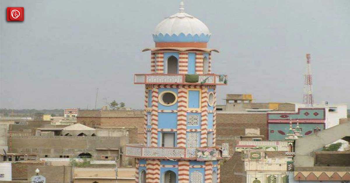
Here are some of the exciting places you might consider visiting:
The most prevalent casts are Sindhi + Muhajir and Sindhi (jatoi), primarily of influential individuals.
This city is administratively subdivided into 15 Union Councils. Union Councils List:
Records show that Mehar Taluka was established in 1848 as a division of Dadu District under British administration, with Mehar serving as the administrative centre. The taluka, along with the entirety of Sindh, was formerly part of British India’s Bombay Presidency.
It was once a taluka in Sindh province’s Larkana District. This information may be found in a historical account of Mehar published in the Imperial Gazetteer of India more than a century ago. Mehar, which had an area of 328 square miles and stood at an elevation of around 162 feet, was the capital of its 64 settlements.
In 1901, there were 58,434 people living there, a considerable rise from 48,320 ten years earlier. With 178 persons per square mile, this density was higher than the district average.
In 1903–04, 2.8 lakhs were collected in taxes and land revenue. The main crops grown in the taluka were rice and jowar, which the Western Nara River irrigated and one of its tributaries.
The text does point out that the city was more productive before the 1874 floods. No garden was left standing because of the salty water caused by these floods. Rainfall became the only source of sustenance for cultivation in the western slopes.
Some of the most popular FAQs are included below.
Tehsil is a district-level administrative division in Pakistan’s Sindh province’s Dadu District.
The city has a well-known reputation for producing mehndi, or henna.
The Tehsil is roughly 928.0 square kilometres in size. (Precise demographic data may not be easily accessible.)
The most common way to reach the city is by road, bus, car, or taxi. The closest airport is Sukkur Civil Airport (SKZ), requiring a connecting taxi or bus ride.
Shaheed Aashiq Hussain Jatoi Park, vibrant neighbourhood markets like Shahi Bazaar, and the iconic Kakul Wah Canal are a few options. Other options include visiting the neighbouring Manchhar Lake and Dadu, the district capital.
Most people in Mehar speak Sindhi, while many also understand Urdu.
Mehar has a hot, dry climate with scorching summers and moderate winters.
The name “Mehar” may have come from a personal name or a Sindhi term, while its exact origin is unknown.
This was all about Mehar. For more details, visit Graana.com.
Islamabad: The chairman of the Capital Development Authority (CDA) and Chief Commissioner Islamabad, Muhammad Ali…
Peshawar: The Khyber Pakhtunkhwa government is exploring plans to construct a 31-kilometre outer ring road…
Islamabad: The National Highway Authority (NHA) has spent more than half of its development budget…
Karachi: A high-level meeting chaired by Sindh Minister for Local Government Syed Nasir Hussain Shah…
Riyadh: Saudi Real Estate Co. (Al Akaria) has signed a long-term lease agreement with Amsa…
Rawalpindi: The divisional administration has begun acquiring land for the Rs5 billion Thalian Interchange, a…
Welcome to Graana Blog - Pakistan’s Smartest Property Portal!
For more than a decade our intention has been to revolutionise the real estate industry in Pakistan. The same belief drove the vision of our real estate team, Graana where quality beats quantity.
We have introduced an extremely transparent and purposeful portal where we will help you buy, rent or sell your property. A place where you can sit back relax and let us market your projects and listings. We believe we have set new standards for the future of real estate in Pakistan by providing the smartest property portal.


