The main town and capital of Ratodero Taluka is Rato Dero. This region is a subdivision of the Larkana District in the province of Sindh. The town’s distance from Larkana, the district centre, is around 28 kilometres. Ratodero has been well-known since Pakistan attained independence for its mouthwatering candies and intricately carved Sindhi topis.
The town’s primary source of income these days comes from the sale of rice and paddy, or raw rice. The fact that Rato Dero has a large number of rice mills is indicative of this. In this blog, you will find all the significant details about the city.
| Description | Value |
| Coordinates | 27°48′N 68°17′E |
| Country | Pakistan |
| Province | Sindh |
| Area | Total: 138,002 km2 (53,283 sq mi) |
| Calling code | 074 |
| Number of towns | 60 |
| Number of Union councils | 9 |
Location
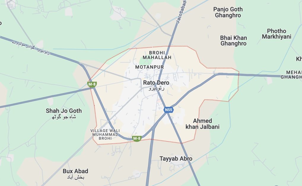
The town of Ratodero is located in Pakistan’s Sindh province and serves as the administrative headquarters of the Ratodero Taluka, which lies within the Larkana District.
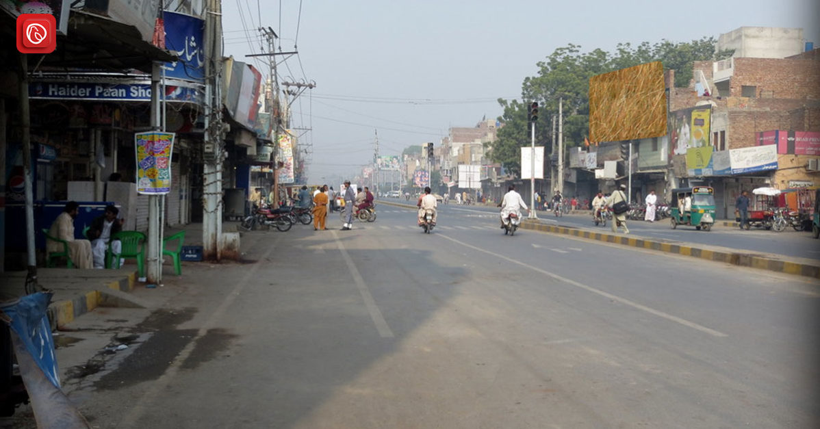
Ratodero is located approximately 28 kilometres from Larkana, the district capital, and is a strategic point on the highway that connects the city of Shikarpur with Larkana. This fortunate position has solidified Ratodero’s status as a regional transportation hub. This fortunate position has solidified.
From Ratodero, a network of highways extends forth, making it simple to reach the nearby cities and villages of Miro Khan, Naudero, Gharrhi Khairo, Jacobabad, and Shahdad Kot.
Accessibility
Ratodero serves as a hub for regional transport and has an extensive road network that connects it to neighbouring areas.
These highways offer easy access to many cities and villages and can be classified as both major thoroughfares and smaller connecting routes.
Below is a summary of some of the main places that may be reached from Ratodero via road:
- Kamber
- Miro Khan
- Naudero
- Jacobabad
- Sijawal Junejo
- Shahdad Kot
- Kamber
- Larkana
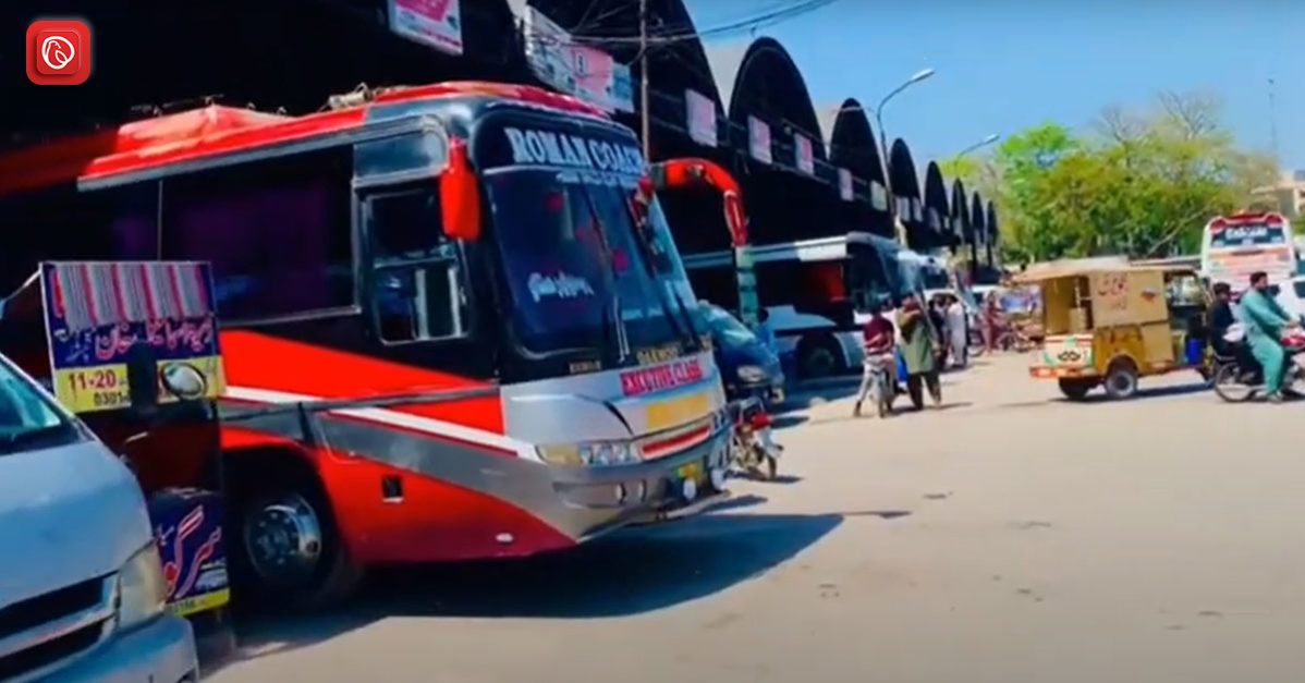
Though exact information on public transport choices is not available currently, the extensive road network indicates that Ratodero is reachable by bus.
Ratodero can also be reached by train, though schedules and routes would need to be confirmed with more research.
A Paradox of Neglect
The birthplace of political titans Benazir and Zulfiqar Ali Bhutto, Rato Dero, is a striking contradiction. Despite having a rich political past, the city is severely neglected, making it difficult for its citizens to achieve their fundamental necessities.
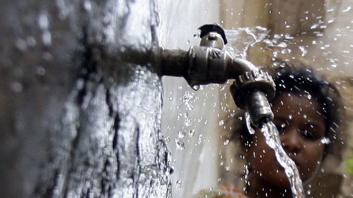
For the residents of Ratodero, getting access to clean drinking water is still a far-off goal. The city is plagued by contaminated water supplies, which poses significant health risks. This is a clear reminder of broken promises—a fundamental right denied.
There are no prestigious HEC universities or institutions in the city. This lack of educational possibilities is stifling the potential of the next generation.
This lack of investment in education brings about a vicious cycle of poverty and restricted upward mobility.
One of the main reasons for concern in Rato Dero is the need for a well-equipped hospital. When medical emergencies arise, residents battle mightily to receive the care they need, putting lives at risk.
Ratodero’s economic future could be better given the lack of factories. Industrial growth prospects result in significant unemployment, which impedes the city’s development even further.
Ratodero’s roads are a reflection of the general disregard. Inadequate upkeep of infrastructure impedes economic growth and causes transportation problems. The city is isolated and has less potential because of this lack of investment.
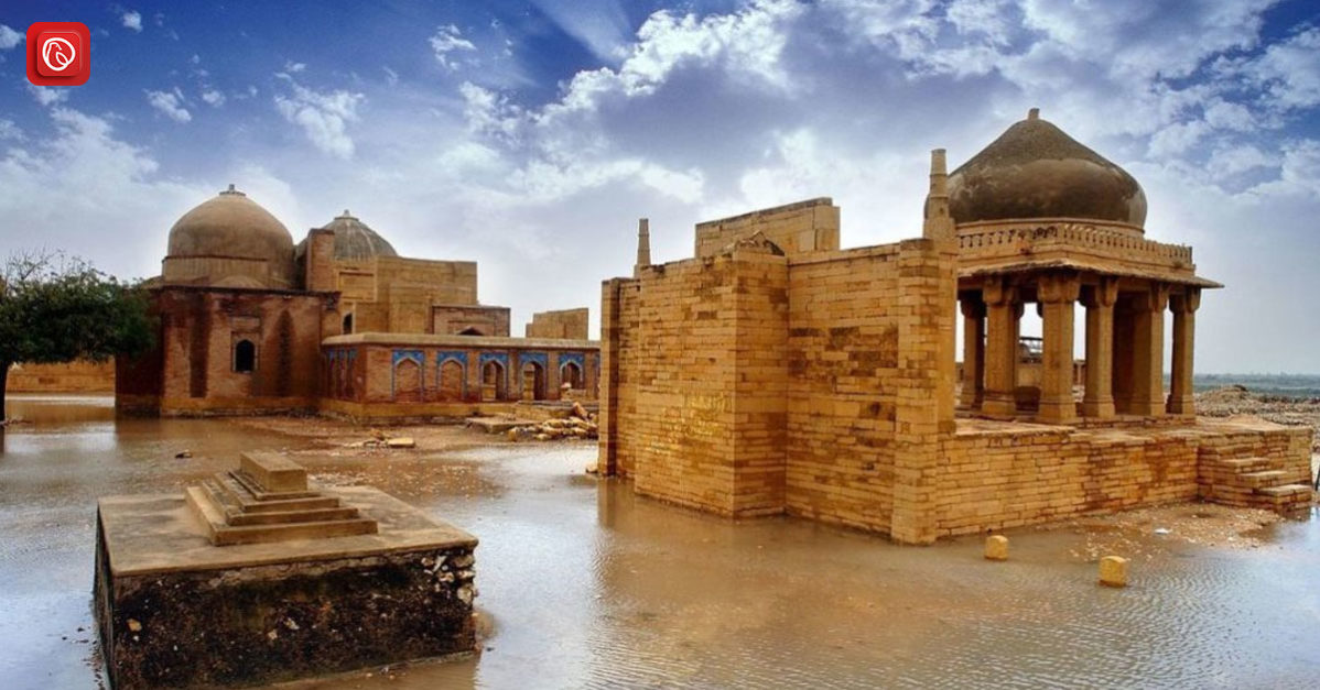
Ratodero: A Tapestry of History
Ratodero has a fascinating history intertwined with tales of empires, religious influence, and invasion.
Sands of Shifting Power
After the first conquest, Ratodero saw several powers come and go. The rule of the Delhi Sultanate shaped the terrain and, subsequently, the Mughal Empire.
A Town Forms (1650s)
Ratodero’s roots are thought to be approximately 350 years ago. During the period of British control, it gained significance and was even temporarily included in the Bombay Presidency. It then became a Taluka (sub-division) within Larkana District.
A Bustling Centre (19th Century)
Historical accounts depict a prosperous Rato Dero during the 1800s. According to census data, the population has significantly increased, and the “Imperial Gazetteer of India” characterises it as the district’s most densely inhabited Taluka.
Life Along the Canal
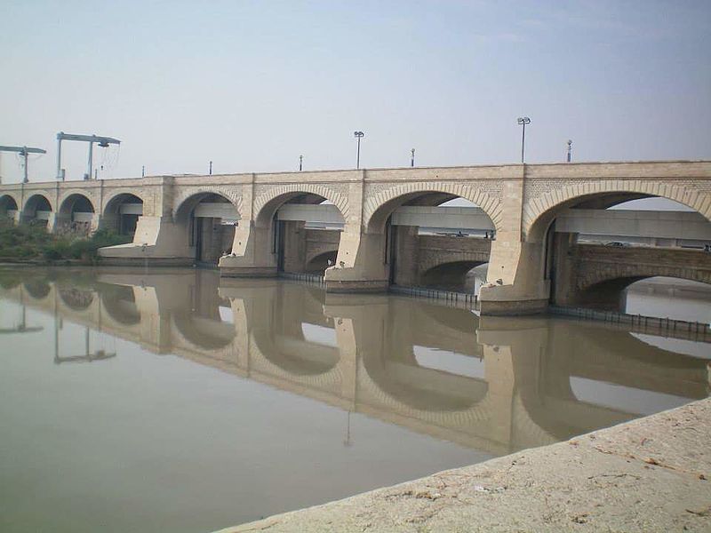
Ratodero’s history was significantly influenced by the Sukkur Wah Canal, which formerly flowed close to the shrine of Saint Nadar Shah.
This stream served as an essential supply of irrigation and a trading conduit, enabling boat transportation for business with neighbouring communities.
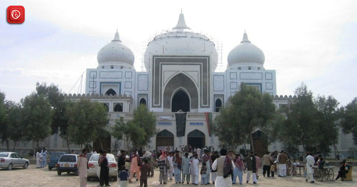
Cultural Diversity
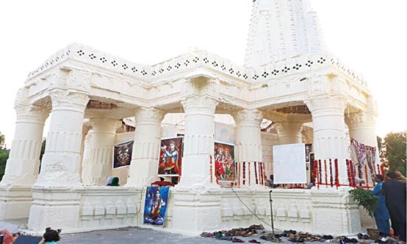
A multitude of cultures, customs, and faiths coexist in Ratodero. Although Muslims make up the majority of the population, there are sizable Hindu and Christian minorities in the city.
The architecture, food, and festivals of the city all showcase the diversity of its cultures. Among the city’s notable sites are mosques from antiquity, Hindu temples, and Muslim saints’ shrines.
The city also holds a number of festivals and cultural events, such as the Urs of Lal Shahbaz Qalandar, which draws thousands of followers from all across the nation.
Economy of Ratodero
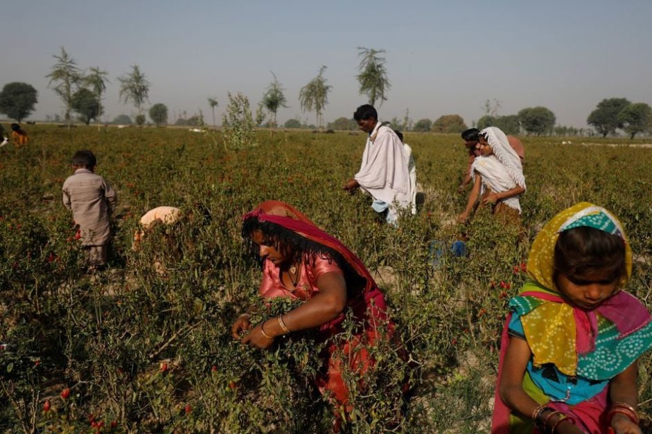
Because Ratodero is situated in the rich Indus Valley, farming is the primary industry in the region. The city is well-known for producing cash crops such as cotton, wheat, and sugarcane.
In addition to farming, the town boasts small-scale businesses such as garment production, rice milling, and cotton ginning.
The city’s advantageous location along the National Highway has turned it into a hub for logistics and trade, supporting the expansion of companies and industries.
Healthcare Facilities
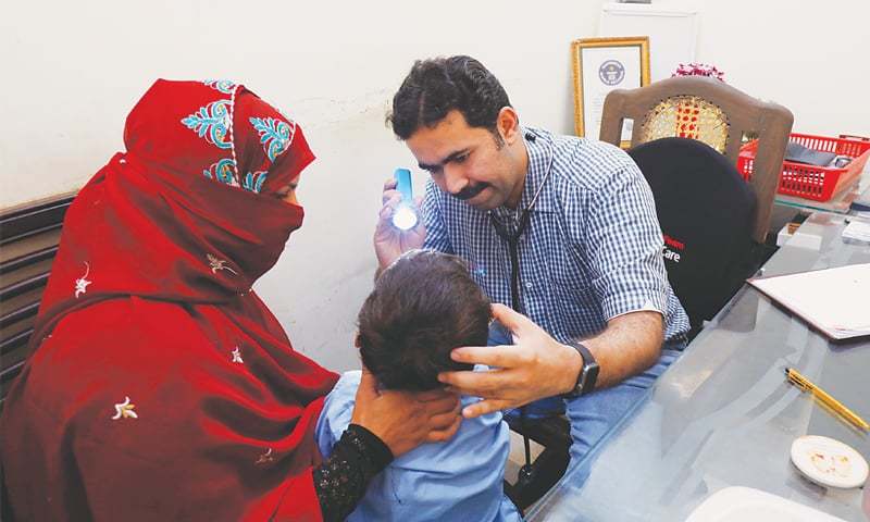
The people in Ratodero can receive medical care from a number of health centres. Hospitals, clinics, and dispensaries can be found in the city, both private and public.
The creation of multiple medical schools and hospitals in the town has resulted in notable advancements in the field of healthcare.
Nonetheless, the city continues to experience health issues, such as a shortage of medical professionals and a high incidence of contagious infections.
FAQs
Following are some of the top FAQs.
Where is Ratodero?
This is a small town located in Larkana, Sindh.
What is the total area of Ratodero?
The total area of Ratodero is 138,002 km2.
How do you get to Ratodero?
Depending on where you’re coming from, you might get a flight, train or bus to travel to the town.
What is Ratodero famous for?
Rato Dero is mainly famous for its sweets, such as halwa.
What language is spoken in Ratodero?
Sindhi is the most widely spoken language and the local language of the region. However, Urdu, the national language of Pakistan, is also spoken and understood by the locals there.
What is the weather like in Ratodero?
Ratodero has a hot desert-like climate. The summers are sweltering and dry, while the winter season is relatively cold and pleasant.
Is Ratodero safe to visit?
Safety can vary depending on the current situation and specific areas. It’s always wise to check travel advisories for Pakistan before your trip.
This was all about Ratodero. For more information, visit Graana.com.