Battagram is a district in Khyber Pakhtunkhwa province, Pakistan, that is surrounded by mountains. Battagram is well located at the start of the China-Pakistan Economic Corridor (CPEC) and is situated along the well-known Karakoram Highway, which connects China and Pakistan. The divisional headquarters is located in Abbottabad, 291 kilometres away, and the provincial capital is located in Peshawar, 93 kilometres away.
The national capital is located in Islamabad, 227 kilometres away. Covering an area of 1,301 square kilometres, 476,612 people called Battagram home as of the 2017 census. Pashto is the predominant language used in the district. Graana.com brings you a complete insider to the district of Battagram, for more details, keep scrolling.
Key Features
| Demographics | 2017 |
| Area Sq.Kms | 1301 |
| Population | 476612 |
| Population Density / Sq.Km | 366 |
| Rural Population | 476612 |
| Total Housing Units | 54271 |
| Housing Units having Electricity | 258896 |
| Housing Units Having Piped Water | 167815 |
| Housing Unit using Gas for cooking | 1203 |
| Alternative Names: | Batagram, Batagrām, Batgram, Batgran, Batgrām, Batgrān, Battagram, Battagram City, Battagrām |
| Mindat.org Region: | Khyber Pakhtunkhwa Province, Pakistan |
| Region: | Battagram District, Khyber Pakhtunkhwa Province, Pakistan |
| Latitude: | 34° 40′ 37″ N |
| Longitude: | 73° 1′ 23″ E |
| Lat/Long (dec): | 34.67719,73.02329 |
| Köppen climate type: | Cfb : Temperate oceanic climate |
| Population: | 700,000 (2016) |
| Mindat Feature ID: | 1183105 |
| Long-form Identifier: | mindat: 2:6:1183105:3 |
| GUID: | 2b3d68f8-351e-4b90-bbab-a4a15d81e839 |
Location of Battagram
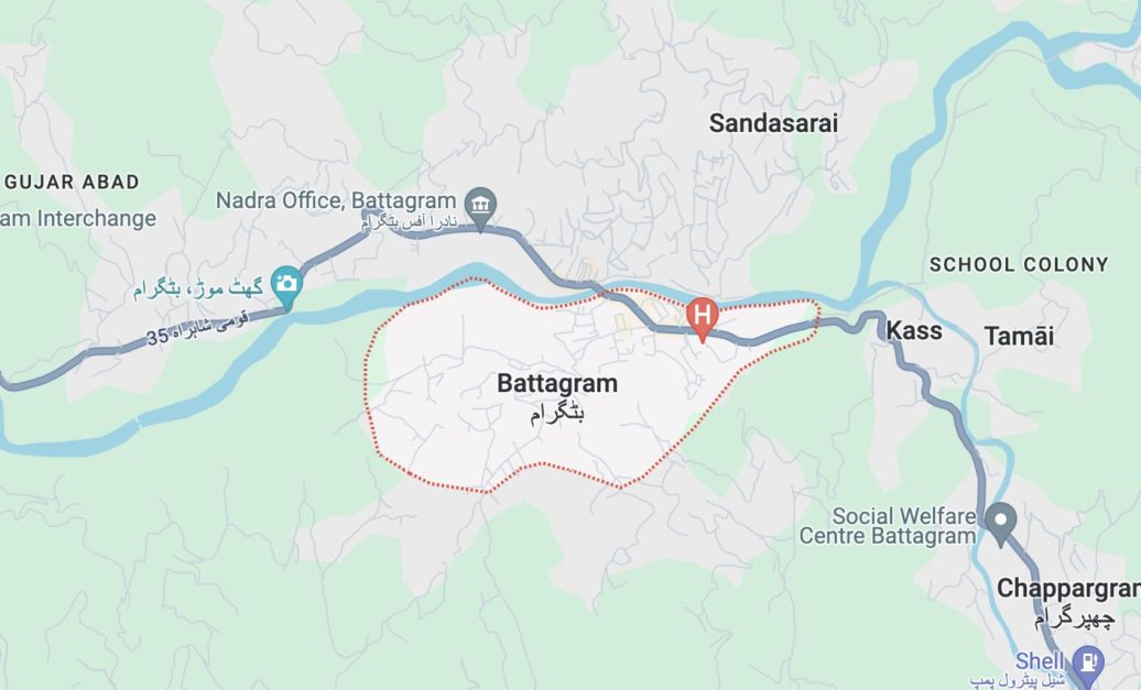
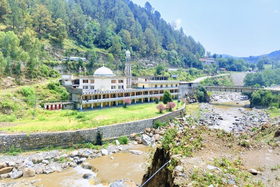
The town of Battagram is located in Pakistan’s Khyber Pakhtunkhwa Province. It is situated in a lovely area surrounded by mountains, alongside the Karakoram highway, with views of the verdant Chattar Plains and meadows. Its elevation is 1038 metres (3408 feet), and its geographic coordinates are 34°41’N 73°1’E.
Battagram’s environs include the following districts on its edges:
- The district of Kohistan to the north
To the east is Mansehra District - To the south is Torghar District (previously the tribal territory of Kala Dhaka)
- To the west is Shanghaila District.
Furthermore, Battagram is ideally situated on the Karakorum Highway, a significant route that links China and Pakistan. This puts Battagram in a prime location for the major development project known as the China-Pakistan Economic Corridor (CPEC).
It’s crucial to remember that Battagram is the name of both the nearby district and the town itself. Prior to 1993, this district belonged to the Mansehra district; however, it now has its own administrative standing.
How to Reach Battagram?
The accessibility of Battagram is dependent upon your preferred mode of transportation and starting place. The choices are broken down as follows:
- Travel by air: Arrive at Peshawar International Airport (PEW) or Islamabad International Airport (ISB). Depending on traffic, it will take 3–4 hours to go to Battagram in a taxi or rental car.
- Bus: Battagram has excellent access to the roads. You can get there by bus from major Pakistani cities including Islamabad, Peshawar, and Lahore; the length of the trip depends on the service type and distance covered.
- Car: You can have a flexible itinerary if you rent a car or hire a driver. Battagram may be reached by the breathtaking mountainous Karakorum Highway. When travelling in unknown conditions, especially on mountain roads, be mindful of the possibility of difficulties.
- Train: There isn’t a direct train that goes to Battagram. Think about taking the train to one of the surrounding cities, such as Peshawar or Islamabad, and then taking a bus or cab to Battagram.
Popular Places Near Battagram
There are some lovely natural features in the neighbourhood of Battagram. Here are some of the places:
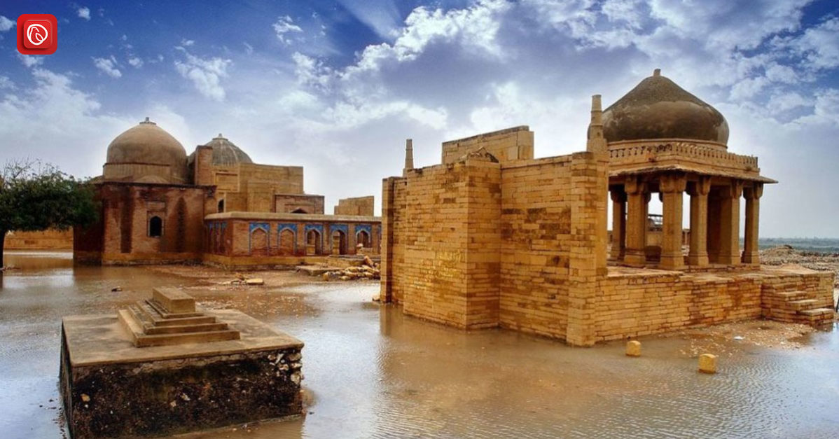
National Park of Saif ul Malook
There’s a good reason why this park attracts a lot of tourists. It has breathtaking landscapes with lakes, woods, and mountains. There are lots of opportunities for fishing, hiking, and camping.
Top Thandiani

The Abbottabad District contains the highland station of Thandiani. People who want to get away from the heat of the plains frequently make this trip. There are other hiking paths nearby as well.
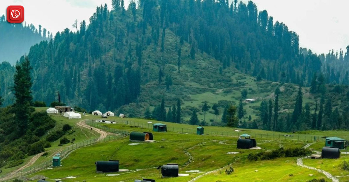
The Alluring Valley of Allai
Situated in the Allai Tehsil of Battagram, the Allai Valley is a breathtakingly beautiful area. The boundaries of the valley are set by towering mountain ranges.
Peaks on the Kohistan side soar to heights of more than fifteen thousand feet, and another range extends from the Afghan border to the Indus River in the Thakot area. The valley’s scenic qualities are enhanced by the dense trees that cover the mountainsides.
A beautiful treasure in the valley, Galai Medan Gantar features cool streams and grassy meadows brimming with fruit orchards. For lovers of the great outdoors looking for breathtaking scenery, this alluring place is a sanctuary.
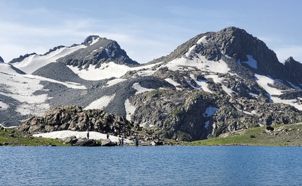
Sukai Sar
This peak beckons to those looking for a more daring adventure. Sukai Sar, the highest point in the Allai Valley, is a tranquil haven encircled by colourful meadows, shimmering streams, and lush woodlands.
The hike up to Sukai Sar is an experience in and of itself, taking you through a thick forest canopy, next to cool streams, and up steep hills. This trip, which is relatively unknown, offers hikers unmatched views of the valley’s natural splendour.
From Allai town, rent a jeep to Shamsher village to start your trek. The hike from Shamsher village to the base camp at Sukai Sar should take one day. The mountain itself needs a more committed expedition that takes two to three days to scale.
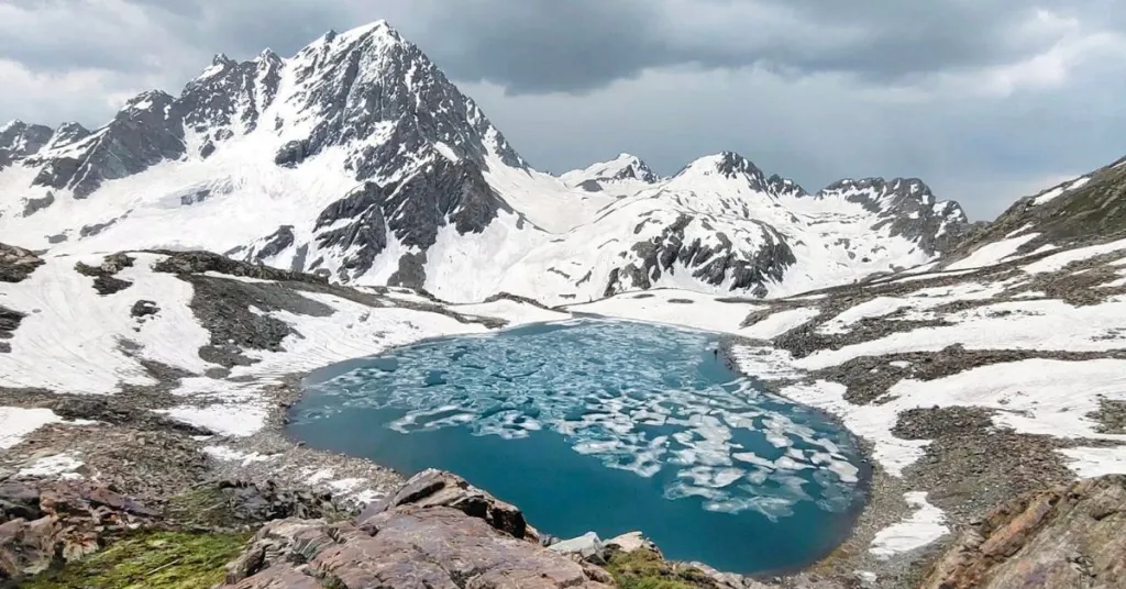
Khapero Lake
This is a glacier lake next to Sukai Sar’s base camp. Its bluish-grey reflection casts a mesmerising reflection of the surrounding mountains. Although this site is undoubtedly picturesque, it is not advisable to camp here because of a border dispute between the Kohistan and Allai populations.
Climate of Battagram
Battagram has a humid subtropic climate (Köppen climatic classification: Cfa), with a pleasant, typically warm, and moderate temperature. In Battagram, the yearly average temperature is 18.5 °C and the mean precipitation is 1218 mm. There is a great deal of precipitation, even during the driest months.
With 28 mm of precipitation on average, the driest month is November, while July is the wettest, with 229 mm on average. June has an average temperature of 27.9 °C, making it the hottest month of the year. The average temperature in January, the coldest month, is 7.6 °C.
Early History
Specific details about Battagram’s pre-colonial past are scarce. However, its mountainous location suggests it likely served as a route for trade and migration for various communities throughout history.
- 1993: Battagram gained official recognition as a district, separated from the Mansehra district. This marked a significant step towards greater administrative autonomy.
- 1994: The Peshawar High Court declared Battagram a Sessions Division. This established a higher court within the district, streamlining the legal system.
- By 2018: A well-structured District Judiciary system with various levels of judges was operational in Battagram. Currently, several courts, including one in the Allai sub-division, function within the district.
Police Infrastructure
To uphold peace and order, police stations have been erected at a number of places throughout the area over time. Among these stations are Chanjal, Kuza Banda, Shamlai, Banna Allai, Pazang Allai, and Battagram.
Administrative Divisions
To ensure effective administration, the Battgram district is further split into Union Councils and sub-divisions. These divisions are called Allai and Battagram. Many additional councils are included in the Union Councils, such as Ajmera, Banian, Battagram, and Batamori.
Hydel Power Project in Battagram
Hydropower plays a significant role in Battagram’s energy infrastructure. Here’s a breakdown of hydropower in Battagram:
Major Hydropower Project
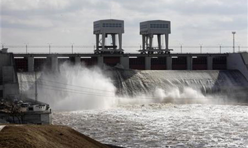
Situated in the Battagram District of Khyber Pakhtunkhwa province, Pakistan, on the left bank of the Indus River, the Allai Khwar Hydropower Project is a 121 MW run-of-the-river project. It makes a significant contribution to the district’s electrical production.
The project’s construction started in 2003, and it started to run for profit in 2013. With a gross head of 692 metres and a net head of 687 metres, the project makes use of a high head of water to produce power.
It has two 61.5 MW nameplate capacity Andritz Hydro pelton turbines. A significant clean and renewable energy source for the area is the Allai Khwar Hydropower Project.
Micro Hydel Power Stations
Battagram has profited from the erection of micro hydel power plants in recent years, as well as to the Allai Khwar project. These smaller-scale initiatives use rivers’ and streams’ natural flow to provide local communities with electricity
As examples, consider:
- 200 kW micro hydroelectric power plant in Bela Bala
- Shagai 75 kW micro hydroelectric power station
- Beesa Khait micro-hydroelectric power plant with a 30-kW capacity
These stations give settlements a dependable and healthy supply of electricity, fostering growth and raising standards of living.
Agriculture, Livestock and Forest
The lush fields of Battagram are home to a wide range of crops. The main crops that are farmed all year round are rice, wheat, and maize. Additionally, the area grows seasonal crops in accordance with the Rabi and Kharif cycles.
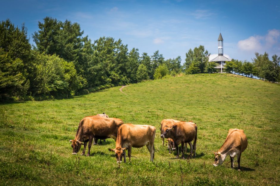
Another important industry in Battagram that has the potential to be much more productive is livestock raising. Livestock offers the potential for better profits when compared to other investment choices in the district.
Additionally, Battagram’s 37,983 hectares of forest cover offer a chance to obtain carbon credits, which might boost the local economy.
| Land Statistics | Cultivated Area (Hectares) | Cropped Area (Hectares) | Uncultivated Area (Hectares) | Forest Area (Hectares) | N.A. for Cultivation |
| Total | 24,173 | 29,560 | 68,824 | 37,983 | 4,093 |
Mineral
While mining activity is less extensive compared to neighbouring districts, Battagram has potential reserves of minerals like iron ore and feldspar. The following table shows the annual production of minerals in Battagram District:
| Mineral | Production (Year) |
| Iron Ore | 7,000 (2012-13) |
| Feldspar | 485 (2011-12) |
| Granite | 270 (2011-12) |
FAQs on Battgaram
The following are some of the top FAQs on Battagram.
What location is Battagram?
The Pakistani province of Khyber Pakhtunkhwa contains the mountainous district of Battagram. It is located along the Karakoram Highway, which connects China and Pakistan.
Which language is most spoken in Battagram?
The predominant language of Battagram is Pashto. But there is also spoken Gujri and Hindko.
Battagram became a district when?
1993 saw Battagram become a district after splitting from the Mansehra district.
What is Battagram’s main electrical source?
An important source of electricity is hydropower, of which the Allai Khwar Hydropower Plant is a major supplier.
Which crops are cultivated primarily in Battagram?
Throughout the year, the main crops that are grown are rice, wheat, and maize. The Rabi and Kharif cycles are also followed when growing seasonal crops.
Is it significant to raise livestock in Battagram?
Indeed, raising cattle is a big business with significantly bigger profit margins than other investment options.
How can Battagram be reached?
The capital city of Islamabad is about 227 kilometres away from Battagram, which is reachable by road.
What is the Battagram climate like?
Because of its high terrain, Battagram enjoys a temperate climate with warm summers and mild winters.
This was all about Battagram. For more information, visit Graana.com.