The Jhelum River, one of the tributaries of the mighty Indus River, originates from the picturesque Pir Panjal Range. As it journeys through the lush green plains and flourishing meadows of the Kashmir Valley, it paints a mesmerising natural canvas.
A leisurely walk alongside the Jhelum River’s banks treats you to some of Mother Nature’s finest works and awe-inspiring vistas, with the swift-flowing river as your companion. Much like the River Chenab, the Jhelum River is a wellspring of inspiration, not only for writers and poets but also for brave warriors deeply connected to their homeland.
This mighty river, coursing through some of Punjab’s most significant cities, has instilled a profound love for the motherland in the hearts of these valiant defenders.
The Jhelum City, situated on the river’s western bank, has a history of providing soldiers to the British Army during the pre-independence era. Even after the independence of Pakistan, Jhelum continued to produce noble patriots who fearlessly defended their homeland. This legacy has earned Jhelum the ‘Land of Martyrs’ titles and the ‘City of Soldiers’.
Graana.com has discussed everything you need to know about the Jhelum River.
Geography
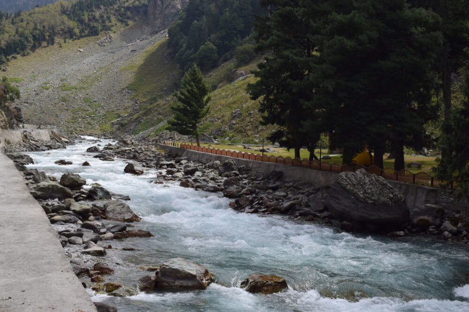
The journey of the Jhelum River commences from the pristine Verinag Spring, nestled at the base of the Panjal Pir mountain range in the southern region of the Kashmir Valley. From this picturesque origin, the Jhelum River meanders through the scenic landscape, passing through Srinagar Kashmir and gracing the vast expanse of Wular Lake before making its way into Pakistan through a narrow, dramatic ravine.
As it continues, the Jhelum River encounters the enchanting Neelum River, the largest known tributary of the Jhelum. The scenic union occurs at Domail Muzaffarabad, creating a harmonious blend of waters. Subsequently, as the Jhelum River flows through the captivating Kaghan Valley, it meets the splendid Kunhar River. The Kunhar River, with its resounding and forceful currents, captivates the senses and offers a mesmerising display of changing hues.
The Jhelum River’s course includes a notable passage through the Kohala Bridge. At this point, the river once again joins the Poonch River, adding to its waters. From there, the Jhelum River continues its journey, creating the world’s seventh-biggest natural water reservoir, the impressive Mangla Dam, located in the Mirpur district.
As the river flows through the Jhelum District in Punjab, it begins to define the boundary between Sindh Sagar Doabs and the Chaj, two prominent regions in Punjab. Its journey culminates in a confluence with the Chenab River at Trimmu in the District of Jhang. Subsequently, the Chenab River combines with the Sutlej River, forming the famous Panjnad River, which eventually merges with the mighty Indus River at Mithankot.
Barrages and Dams
Under the provisions of the Indus Water Treaty, a bilateral agreement signed between India and Pakistan in 1960 to manage the waters of the Indus Basin rivers, several crucial water control structures have been established along the course of the Jhelum River. These structures play a vital role in regulating the river’s flow and facilitating the distribution of water resources. Here are the key details of these important water control structures:
Mangla Dam (1967)
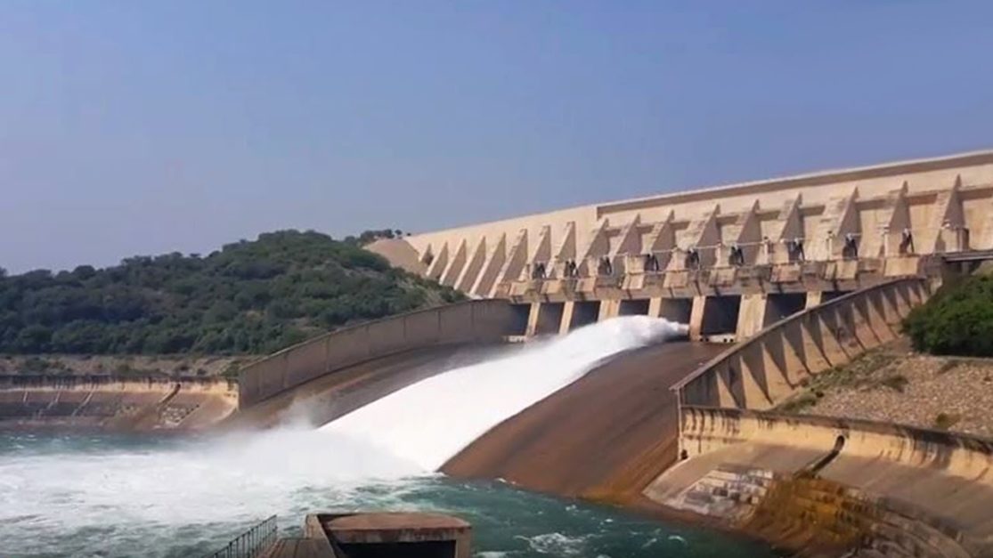
The Mangla Dam, a remarkable engineering feat, was constructed in 1967. It is the seventh-biggest-earth-fill dam globally and boasts an impressive storage capacity of approximately 5,900,000 acre-feet. This dam is pivotal in water storage, flood control, and electricity generation.
Rasul Barrage (1967)
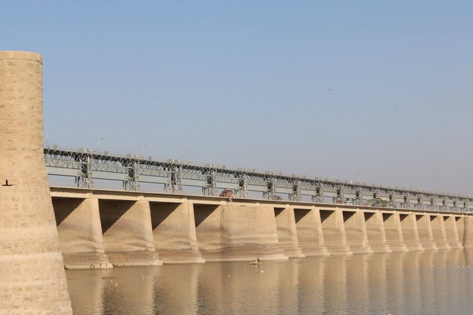
The Rasul Barrage, a significant water control structure, was established in 1967. It is one of the barrages in Pakistan. Spanning an impressive 3,000 feet, it is strategically located between the towns of Jhelum and Mandi Bahauddin. This barrage regulates the river’s flow, with a discharge capacity of approximately 850,000 ft³/s (24,000 m³/s), contributing to irrigation and water distribution.
Trimmu Barrage (1939)
The Trimmu Barrage, with historical significance dating back to 1939, is present around 90 kilometres from Mari Shah Sakhira. Positioned at the confluence of the Jhelum and Chenab Rivers, it serves a vital role in managing water discharge, with a maximum capacity of approximately 645,000 ft³/s (18,000 m³/s).
Victoria Bridge (1933)
The Victoria Bridge, also known as Haranpur Bridge, is a testament to engineering from 1933. This bridge spans approximately 1 kilometre and is primarily utilised by Pakistan Railways, facilitating transportation and connectivity across the river.
As the Indus Water Treaty mandates, these water control structures are integral to efficiently managing and utilising water resources in the Jhelum River basin. They contribute to the region’s irrigation, flood control, electricity generation, and water resource management.
Frequently Asked Questions (FAQs)
1. Where does the Jhelum River originate?
The Jhelum River originates from the Verinag Spring, located in the Pir Panjal Range of the Kashmir Valley in the Indian-administered union territory of Jammu and Kashmir.
2. What is the total length of the Jhelum River?
The Jhelum River has a length of approximately 725 kilometres (450 miles), making it one of the prominent rivers in the region.
3. What is the significance of the Jhelum River in the region’s agriculture?
The Jhelum River and its dams and barrages play a vital role in irrigation, particularly in Pakistan’s Punjab province. Water stored in reservoirs like Mangla Dam irrigates agricultural lands, enhancing crop production.
4. How does the Jhelum River contribute to energy generation?
The river has several hydropower projects and dams, including the Mangla Dam, which generates regional electricity. These hydropower facilities harness the river’s flow to produce clean energy.
5. What are some notable water control structures on the Jhelum River?
Key water control structures on the Jhelum River include the Mangla Dam, Rasul Barrage, Trimmu Barrage, and Victoria Bridge. These structures serve purposes like flood control, irrigation, and transportation.
6. Is the Jhelum River associated with any historical or cultural significance?
Yes, the river has historical and cultural importance. The city of Jhelum, located on its western bank, is known for its contributions to the military. It’s often called the “City of Soldiers” or the “Land of Martyrs.”
7. What happens to the Jhelum River after it merges with the Chenab River
The Jhelum River merges with the Chenab River, and together, they flow into the Sutlej River, forming the Panjnad River. The Panjnad River eventually joins the Indus River at Mithankot.
8. Are there any environmental conservation efforts related to the Jhelum River?
There are efforts to conserve and protect the Jhelum River’s ecosystem and water quality. Various organisations and initiatives work towards sustainable water management and preserving the river’s biodiversity.
9. Can I visit the Jhelum River for recreational purposes?
Yes, the Jhelum River offers scenic beauty with picturesque landscapes surrounding it. Visitors can enjoy boating, fishing, and picnicking along its banks, particularly in the Kashmir Valley region.
For more related information, visit Grana Blog.