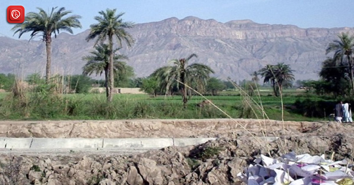
Tucked away in Pakistan’s Khyber Pakhtunkhwa province is the enthralling town of Paharpur, which is rich in culture and history. This bustling town functions as the administrative hub of Dera Ismail Khan District and is home to Paharpur Tehsil.
At an elevation of 173 metres and in a unique position at 32°6’8N 70°58’12E, Paharpur provides a window into the heart of Pakistan’s rich tapestry. Prepare to discover Paharpur’s hidden treasures and hospitable ambience.
Graana.com bring you a comprehensive guide to the town of Paharpur; for more details, keep scrolling,
Highlights
| Field | Information |
| Population (2017) | 381,086 |
| Area | 1,657 km² |
| Population Density (2017) | 230.0/km² |
| Capital | Dera Ismail Khan |
| Tehsils | D.I. Khan, Kulachi, Paharpur, Paroa, Daraban, Drazanda |
| Location | 32°6’8N 70°58’12E, Altitude: 173 meters (570 feet) |
| Union Councils | Miran, Banda Kurai, Kathgarh, Kurai, Giloti, Paharpur, Kech, Mussa Zai Sharif, Dhap Shumali, Daraban, Cheh Kan, Lunda Sharif, Ratta Kulachi, Malana, Looni, Lathala, Yarik, Abba Khel, Wanda Khan Muhammad, Bilot Sharif, Zandani, Bigwani Shumali, Kirri Khaisore, Kot Jai, Kotla Syedan, Mahra, Dewala, Choudhwan, Kiri Shamozai, Shore Kot, Naivela, Mandhra, Paroa, Lar, Maddi |
Location
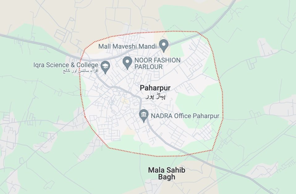
The town of Paharpur is located in the giant Dera Ismail Khan District of Khyber Pakhtunkhwa, Pakistan. In addition to being the tehsil headquarters, this dynamic town also functions as the union council. It is the administrative hub of Paharpur Tehsil.
In addition to its administrative importance, Paharpur has a distinct location on a map. Geographically speaking, it is located at 32°6’8N 70°58’12E, 173 metres (570 feet) above sea level. This corresponds to a location around Pakistan’s northwest and provides an overview of the nation’s varied topography.
How to Reach Paharpur?
Here is how to reach Paharpur.
From Lahore
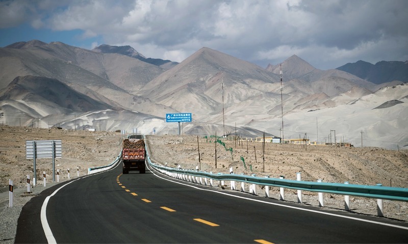
Depending on traffic and the route taken, the trip from Lahore to Paharpur takes about 8 to 10 hours, covering a distance of roughly 600–650 kilometres. These are the two choices:
- Indus Highway and M-2 Motorway: This quicker route takes eight to nine hours. After passing through Sukkur on the Lahore-Islamabad Motorway (M-2), continue on the Indus Highway (N-55) toward Dera Ismail Khan. Expect to pay a toll on M-2.
- Grand Trunk Road (GT Road): This route is more scenic but takes longer (9–10 hours). After passing through Faisalabad, Multan, and Bahawalpur on the ancient Grand Trunk Road (N-5), join the Indus Highway and head towards Dera Ismail Khan.
- Using Public Transit: Search for express buses from Lahore to Dera Ismail Khan. To get to Paharpur, use a local bus or taxi from Dera Ismail Khan. Public transport availability and schedules vary, so check locally at the bus terminals in Lahore.
From Karachi
It takes about 15–17 hours to travel the considerable 1000–1100 kilometre distance between Karachi and Paharpur. The most likely path is as follows:
- The M-9 Motorway and Indus Highway are the fastest options. After travelling the Karachi-Hyderabad Motorway (M-9) until Sukkur, take the Indus Highway (N-55) in the direction of Dera Ismail Khar. Be prepared for M-9 tolls.
From Rawalpindi
By driving, Paharpur is roughly 320–340 km from Rawalpindi. The expected travel duration is 4 to 5.5 hours, depending on the route and traffic. Here are two potential paths that could be taken:
- The quicker route is M-14 and Sargodha-Mianwali Road, which takes 4-4.5 hours. For much of the trip, you’ll drive on the Islamabad-Dera Ismail Khan Motorway (M-14), which may be subject to tolls.
- The Talagang Highway and the Lahore-Islamabad Motorway could take 4-5 hours to complete. For a portion of the journey, you will travel on the Lahore-Islamabad Motorway (M-2), then transfer to the Talagang Highway. There may be tolls on this route as well.
- By Public Transportation: Several coasters and local buses to D.I. Khan exist. It would help to use a local bus or taxi to get to Paharpur from Dera Ismail Khan. However, there may be little information available online on the times and routes of public transport. For options and timetables, it’s best to ask at the bus terminals in Rawalpindi.
Popular and Historic Sites Nearby
Following are some of the popular and historic places near Paharpur.
Wildlife Park D.I.Khan
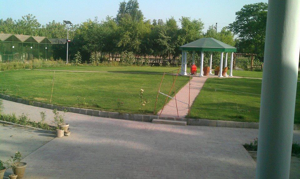
Animal enthusiasts will find paradise in the Wildlife Park D.I.Khan, popularly called the Dera Ismail Khan Zoo. It was founded in the 1980s and offers refuge to a wide variety of animals that are indigenous to Pakistan and other countries. See regal lions, energetic monkeys, elegant deer, and various colourfully plumaged birds here.
In addition, the park has a small fishpond and reptiles. The park provides an educational purpose by teaching visitors about the value of conservation and the fragile balance of our ecology.
The entire family may enjoy an entertaining and educational day excursion to Wildlife Park D.I. Khan, which has picnic spaces and kid-friendly play facilities. Before your visit, make sure to verify the park’s operating hours, as they
Haq Nawaz Park Dera Ismail Khan
Haq Nawaz Park is a vast green haven in the centre of Dera Ismail Khan. This lovely park has well-kept lawns, colourful flowerbeds, and tall trees that give shade and a peaceful ambience. The park is lined with walking routes that are ideal for jogging or taking a stroll.
The playground’s features, including swings, slides, and climbing frames to amuse kids, will make them happy. There is a boating lake in Haq Nawaz Park where guests can take leisurely paddles in paddleboats or observe ducks gliding over the water.
With a rose garden for those searching for a little floral beauty and a dedicated running track for fitness fanatics, the park offers something for everyone’s interests. This park is well-liked by both residents and visitors.
Chashma Barrage
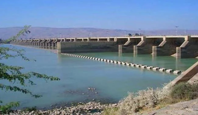
Situated approximately one hour’s drive from Dera Ismail Khan, the Chashma Barrage is an engineering marvel that is not only vital for irrigation but also a well-liked leisure area. This magnificent structure controls water flow, constructed in the 1970s to span the Indus River. It directs it into canals, supplying large farmland areas with vital water.
Viewers may understand the scope of this engineering achievement and the tremendous strength of the Indus River while standing on the barrage. The surrounding area is scenically beautiful, with endless stretches of verdant fields. For family vacations, fishing excursions, and picnics, locals swarm to the Chashma Barrage.
This is a must-visit because of the beautiful views and calm atmosphere. This is a must-visit for anyone looking for a getaway from the city and an opportunity to enjoy the area’s natural beauty because of the tranquil ambience and breathtaking views.
Kurram Garh Fort
Kurram Garh Fort, about 2.5 hours from Dera Ismail Khan, is a worthwhile excursion for history buffs. This impressive fort, situated on a hill in the 18th century, is rich in historical significance. Sikhs constructed it, and then the British used it as an outpost.
The fort’s construction, which features high walls, imposing entryways, and well-placed watchtowers, combines Afghan and Mughal architectural elements. By exploring the ramparts and courtyards of the fort, visitors can travel back in time and envision the lives of the soldiers who once guarded this vital position.
The fort’s expansive viewpoints offer beautiful views of the surrounding mountains and valleys. For those interested in Pakistan’s rich history, the fort is an enjoyable visit, even though due to its historical relevance and unusual position, it may need some restoration.
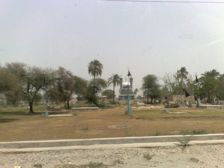
Bilot Fort (Southern Kafir Kot)
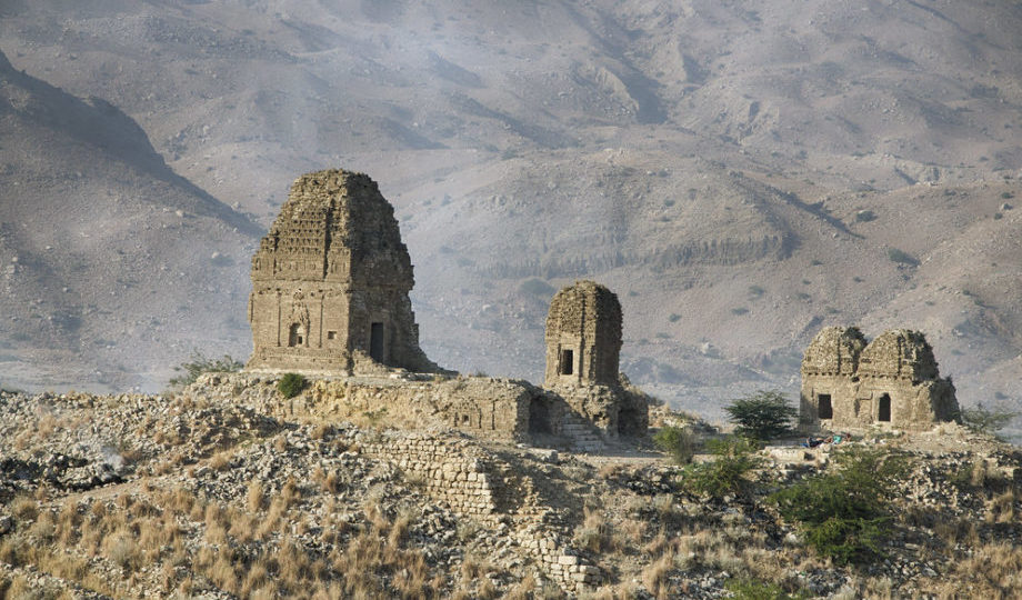
The Southern Kafir Kot, or Bilot Fort, is a reminder of the area’s prehistoric past. This archaeological site, located around 55 kilometres north of the city proper in the Dera Ismail Khan area, is noteworthy for its unique combination of religious and military significance. Although the fort’s precise beginnings are still unknown, some people theorise it was built before Islam.
The main feature of the fort is the remains of a sizable fortress that was probably built to guard the holy places inside its boundaries. According to historical reports, numerous Hindu temples may have existed, but time and negligence have severely damaged these buildings.
However worn, the remnants of these temples’ architectural features indicate their grandeur and may even provide insight into their builders’ religious beliefs and practices.
The attraction of Bilot Fort goes beyond its historical significance. Its advantageous position atop a hill provides stunning views of the surroundings, especially the plains where the Indus River winds. Contrasting the current agricultural fields around the old ruins creates a distinctive visual experience, emphasising the past’s lasting influence in the middle of the present.
Sulaiman Peak (Takht-e-Sulaiman)
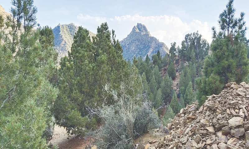
Sulaiman top, also referred to as the “Throne of Solomon” in Pashto as Takht-e-Sulaiman, is more than just a mountain top; it’s a mythical site that piques people’s interest in history and religion. Elevated to a remarkable 3,487 metres (11,440 feet) above sea level, this mountain is the most notable in the Dera Ismail Khan district and the broader Shirani area.
A rich fabric of legends surrounds Sulaiman Peak. The first, as related by the renowned adventurer Ibn Battuta, describes the Prophet Solomon climbing the summit and looking out across the vast South Asian region. The tale goes that Solomon turned back without going any farther because it seemed covered in darkness.
According to a different local myth, Qais Abdur Rashid, the presumed ancestor of the Pashtun people, is linked to the summit. The Pashto name of the mountain, Da Kasī Ghar (Mountain of Qais), comes from this mythology.
Beyond its illustrious reputation, Sulaiman Peak is known for its distinctive environment and breathtaking views. The ascent to the summit is a demanding but worthwhile experience for experienced hikers and environmental lovers.
The mountain slopes provide a variety of scenery, ranging from verdant meadows at lower altitudes to rocky, untamed territory at higher altitudes. The peak is home to uncommon species of birds and other local creatures, making it a haven for unusual flora and fauna.
The expansive vistas are mesmerising for anybody who can reach the peak. Views of the vast plains below, interspersed with towns and farmland, are available. The view of the far-off mountain ranges enhances the magnificent vista.
FAQs on Paharpur
Following are some of the top FAQs on Paharpur.
Where is this located?
Its a village in the Dera Ismail Khan District of Khyber Pakhtunkhwa, Pakistan. It serves as the headquarters of Paharpur Tehsil.
Is Paharpur a big city?
No, Paharpur is a small village.
What are the coordinates of Paharpur?
Its geographic coordinates are 32°6’8N 70°58’12E.
What’s the elevation of Paharpur?
Paharpur sits at an elevation of 173 meters (570 feet).
How many people live in Paharpur?
While specific population data might be limited, Paharpur is likely part of the broader Dera Ismail Khan District, which had a population of around 381,086 in 2017.
What’s the weather like in Paharpur?
The climate in Paharpur is likely similar to Dera Ismail Khan, with hot summers and mild winters.
How can I get to Paharpur?
You can reach Paharpur by car from major cities like Lahore, Karachi, and Rawalpindi.
What language is spoken in Paharpur?
The primary language in Paharpur is likely Urdu, Pakistan’s national language. Pashto and Punjabi might also be spoken in the region.
This was all about Paharpur. For more details, visit Graana.com.